Miharu Takizakura

Miharu Takizakura

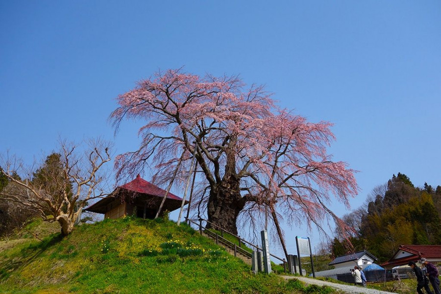
Miharu is a small town in central Fukushima Prefecture. The town’s name means “three springs” and it is easy to see how it got such a name. With cherry, plum, and peach trees blossoming in spectacular displays every spring, it is almost as if spring has tripled! But the most famous of the trees in Miharu is the Miharu Takizakura tree, which is a nationally recognized Natural Monument.
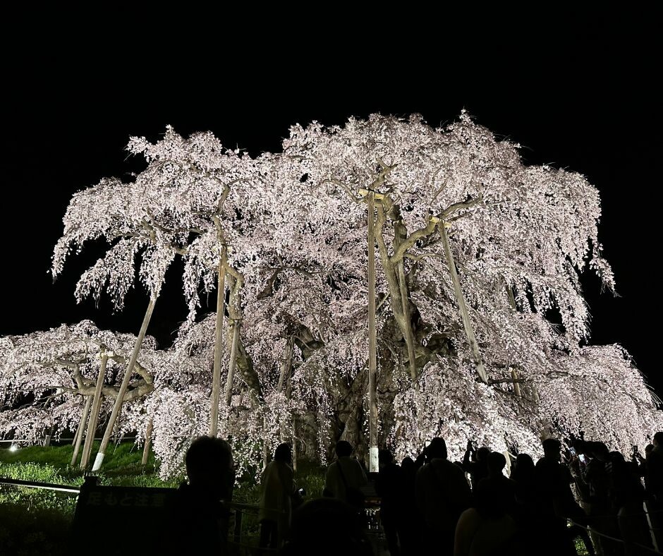
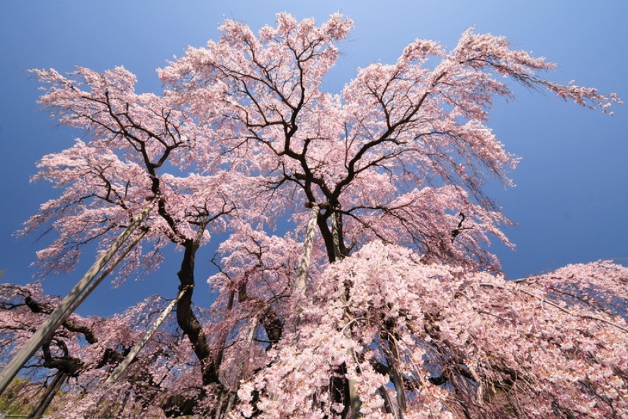
Over ten centuries old, the beautiful Miharu Takizakura is a flowering cherry tree that spreads out in all directions and makes for a breathtaking vista. The cascading blankets of blossoms are how this tree got the name takizakura, or “waterfall cherry tree.” It is even one of the “three great cherry trees” of Japan (along with Usuzumizakura in Gifu and the Jindaizakura in Yamanashi Prefecture).
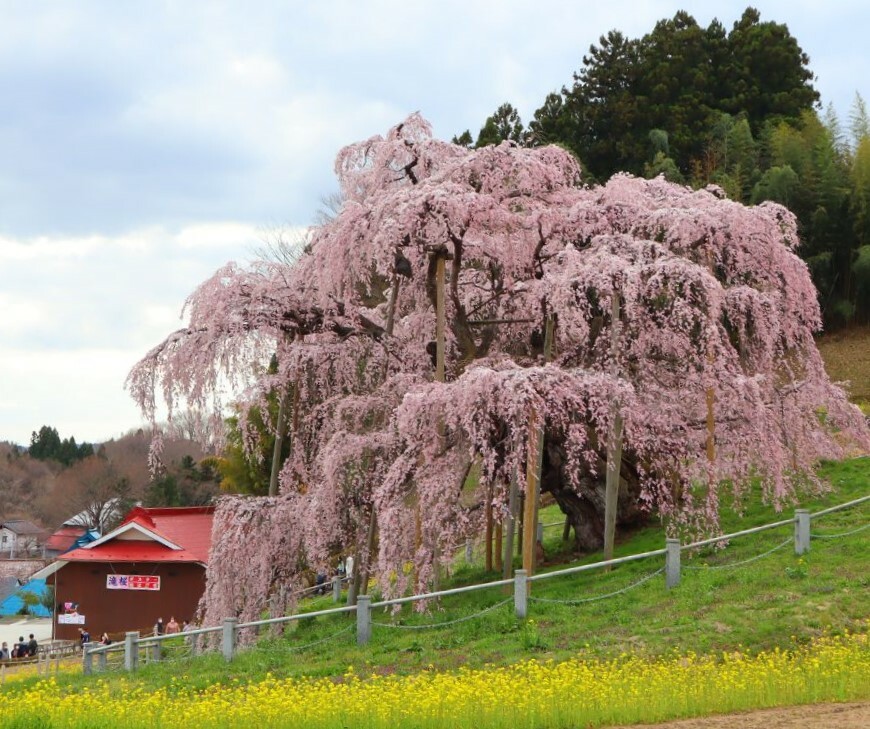
Miharu Takizakura sits in a sakura hollow in order to protect it from the elements while providing excellent drainage. The heavy boughs of the tree are supported by wooden beams and lend to its elegant form. The Miharu Takizakura begins blooming from mid-April. During the day the sight is whimsical, but visit in the evening and you’ll be treated to an almost haunting beauty as the tree is illuminated.

Aside from this huge cherry tree (over 12 meters tall and 18 to 22 meters in spread), the area is also blessed with various wildflowers, including cherry and rapeseed flowers. But, of course, the Miharu Takizakura is what the annual 200,000 visitors are there to see. The view from the base of the sakura is considered to be the most beautiful and the Miharu Takizakura often ranks as the best sakura tree in all of Japan.
Venue Details

Venue Details
Websitehttp://miharukoma.com/experience/183(Automated translation available)
Contact

Miharu Tourism Association

(+81) 247-62-3690

Best Season
  • Spring
ParkingLarge parking lot available (Up to 850 vehicles)
Entrance FeeDuring cherry blossom season: 300 yen for adults (Free for junior high school students and younger)
Accommodation details

Pets: Allowed

Related infoBest time to see cherry blossoms: Mid to Late April
Access Details
AccessSakurakubo, Taki, Miharu Town, Tamura District, Fukushima Pref. 963-7714
View directions
Getting there

By Car: 7.3 km from Funehiki-Miharu I.C. /12.6 km from Koriyama-Higashi I.C. on the Ban-etsu Expressway

By Train: 6.3 km from Miharu Station on the Ban-etsu East Line

Expect traffic jams during the cherry blossom season. During the cherry blossom season, sightseeing shuttle buses run from Miharu station.

Mapcode for Car GPS: 300 840 492*03

Useful Links

Reaching Miharu Takizakura

Japan's Oldest Waterfall Sakura

Fukushima's Top Cherry Blossom Spots

Nearby

The World Glassware Hall
History & Culture

Yamamoto Fudoson Temple

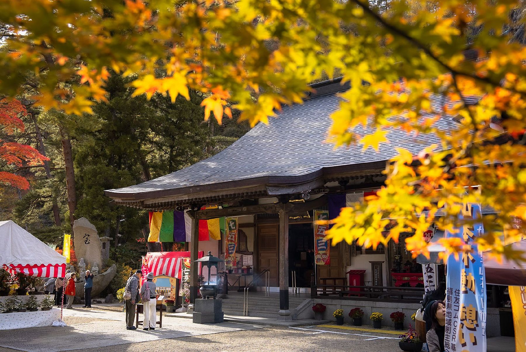
Yamamoto Fudoson Temple was built over 1000 years ago in a rocky cavern. The temple can be reached by taking paths lined with century-old Japanese cedar trees, and climbing a 130-step stone staircase. The cave that makes up part of the Yamamoto Fudoson temple grounds is where the Buddhist deity enshrined at this temple is worshipped. Yamamoto Fudoson Temple is located in Yamamoto Park. This park is centered in a valley – 5 km of which is designated as an Okukuji Prefectural Natural Park. A wonderful place for flower-viewing throughout the year, this area is also great for experiencing beautiful autumn leaves.

The World Glassware Hall
Nature & Scenery

Mt. Issaikyo

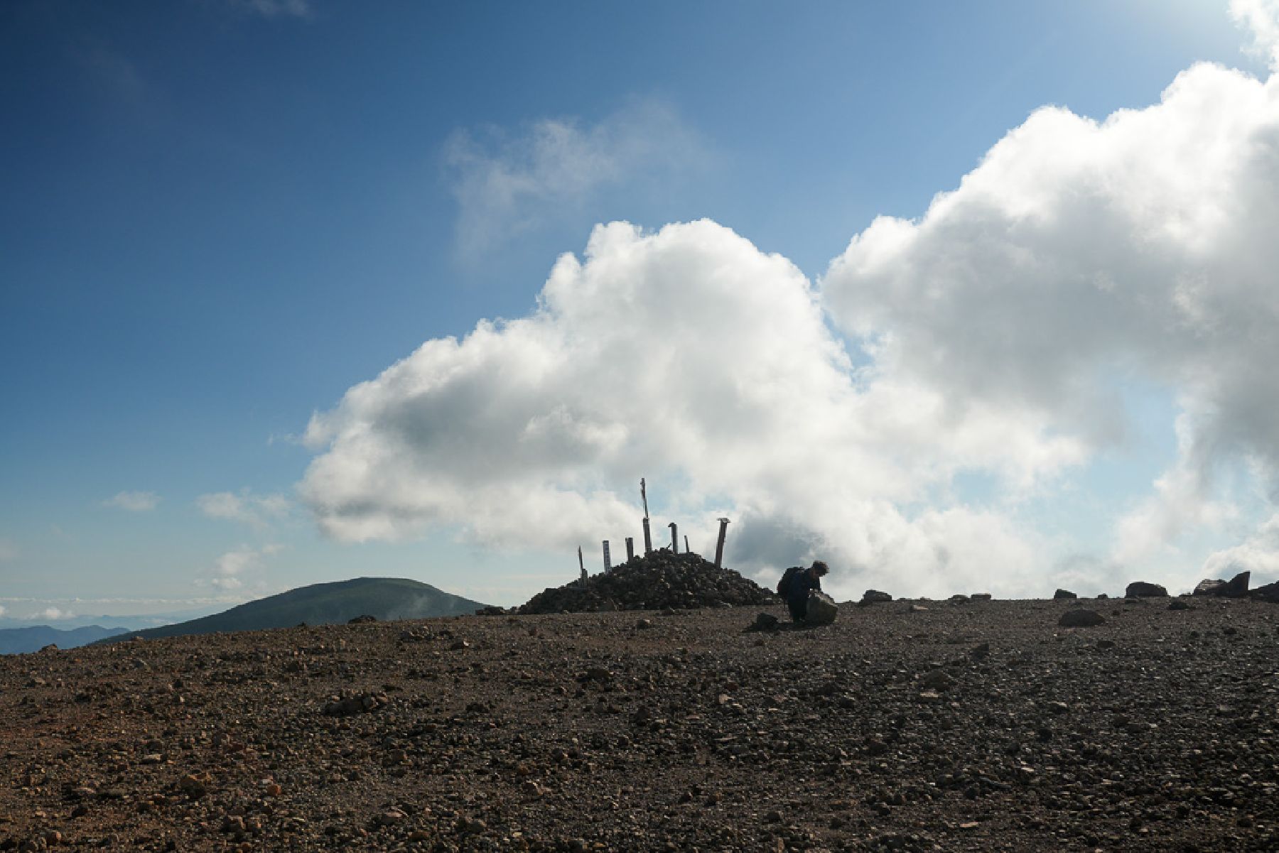
One of the mountains climbable from the Jododaira Plateau, Mt. Issaikyo is a robust several-hour hike suitable for intermediate-level hikers.In addition to spectacular views of the surrounding area, the mountain is also one of the main pathways to, and viewpoints for, the ‘Witch’s Eye’ lake at Goshikinuma, which stretches out in a valley visible from the Issaikyo summit. (The lake is reachable from the summit, although the terrain is relatively steep.)Visitors to the area typically park at the Jododaira Visitor Center, from which they have a choice of options: Kamanuma lake due west, Okenuma Pond to the south, and the Azuma-Kofuji crater with its panoramic views over Fukushima City to the east.To the north, however, stands Mt. Issaikyo. With a summit of 1,949m and rugged terrain on the climb, it may not be suitable for absolute beginner hikers, but nor is it a whole-day slog like climbing Mt. Fuji. Views from the top of the mountain are spectacular and well worth the climb – a blanket of immaculate white clouds spreads out in all directions. Likewise, the ascent gives great views of the Azuma-Kofuji crater with its iconic inverted shape.The Jododaira Plateau is typically best accessed by car, a journey which takes travellers from Fukushima City up the Bandai-Azuma Skyline sightseeing road and offers fantastic views, especially in autumn.Please be aware that the Mt. Issaikyo trail, and the Jododaira Plateau in general, is closed to visitors during winter due to heavy snowfall.

You might also like

Bandai-Azuma Lake Line
Nature & Scenery

Bandai-Azuma Lake Line

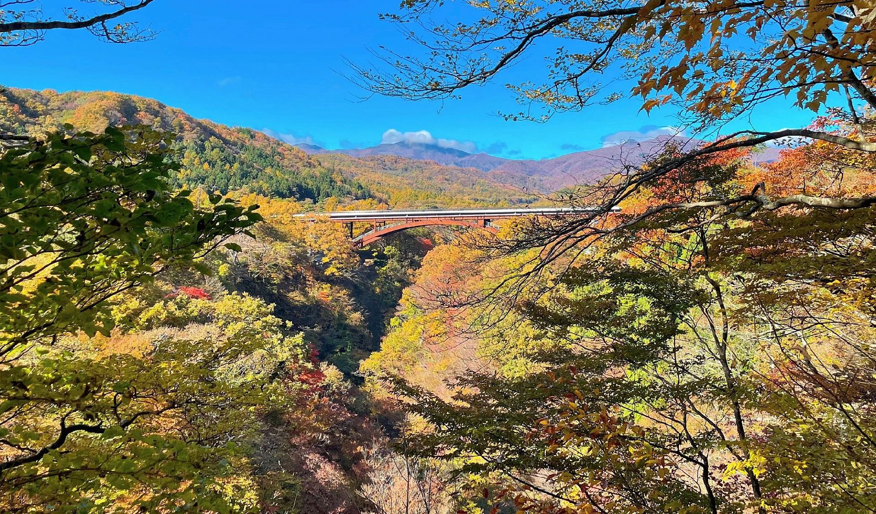
Bandai-Azuma Lake Line is a sightseeing road that runs for 13.1 km, connecting Inawashiro Town and Kitashiobara Village. Outstanding backdrops of hundreds of lakes, including Lake Akimoto, Lake Onogawa, and Lake Hibara can be seen from along the road. The Nakatsugawa Valley, which lies half-way along the route, offers a wonderful view of a combination of rock surfaces polished by strong water currents and woodland greenery. A rest-house area with washrooms stands near the valley and visitors can enjoy trekking along the walking trails from the season of fresh green leaves through to the end of the season of red and yellow foliage. The valley is particularly famous as one of the most scenic foliage-viewing spots in Japan with many photographers visiting from both inside and outside of the prefecture. Enjoy a beautiful drive through this landscape when the new leaves of spring are fresh and green or when the autumn beauty of the valley glistens with red and yellow foliage of beeches, buckeyes, and maples.

Mt. Shinobu (Shinobuyama)
Nature & Scenery

Mt. Shinobu (Shinobuyama)

Mt. Shinobu, with a total altitude of 275 meters, is one of the most recognisable landmarks of Fukushima City. It is estimated that it formed about 500,000 years ago when the Fukushima basin caved in and Mt. Shinobu became an isolated hill, which later became the object of multiple local poems, stories, and legends.Visitors can hike up Mt. Shinobu for unobstructed views of the cityscape. Hikers of all levels can try climbing Mt. Shinobu, as its peak can be reached in a few hours and many parts of it can be reached by car.Each year in April, there is a spring festival with cherry blossom night illuminations that attract hordes of visitors. Summer and autumn are also great times to follow the hiking routes on Mt. Shinobu.A spiritual power spot for locals, Haguro Shrine can be found at the top of the central peak, where there is also a giant straw sandal that weighs about 2 tons and is 12 meters in length and is believed to be among the biggest in Japan. The sandal is paraded along Fukushima City each year in August during the Waraji Festival. Also in Mt. Shinobu, you can find the Shinobuyama Neko Inari Jinja (‘cat shrine’), and the Gokoku Shrine, along with several parks.For stunning views of the city, including the Shinkansen bullet train tracks, head to the Karasugasaki Observation Deck on the western side. Located nearby are the Fukushima Prefectural Museum of Art and the Fukushima Prefectural Library.

Bandai-Azuma Skyline
Nature & Scenery

Bandai-Azuma Skyline

There is a special bus running from Fukushima Station to the Jododaira plateau while the mountain is open. Please visit the Jododaira Sky Access page for more details.Jododaira and the Bandai-Azuma Skyline mountain road are open from April 21, 2026.This sightseeing road that runs from Fukushima City's Takayu Onsen to the Tsuchiyu Pass, commanding panoramic views of the surrounding landscape.The spectacular views that stretch out at an average altitude of 1,350 meters attract visitors time and time again, and Bandai-Azuma Skyline has been selected as one of the 100 Best Roads in Japan.In spring, tourists can enjoy flower viewing while at the same time taking in the otherworldly winter scenery of the "Snow Corridor".In summer, the Nemoto Shakunage (Rhododendron brachycarpum), a species of alpine rose, and other alpine plants display their colorful flowers and fresh, brilliant green leaves. During autumn, the drive warms as roads become enclosed by fiery seasonal leaves.There are also many hot springs in the vicinity of the Skyline where visitors can enjoy a bath and relax stiff muscles while out on a daytrip.The roadway passes next to the crater of Mt. Azuma-Kofuji. Visitors can easily park their car at the nearby guest center and enjoy a short hike up to the crater’s rim.The Bandai-Azuma Skyline Roadway has been selected as one of the top 100 roads in Japan, and unlike many others, this one is free to use. There are rest stops along the way for the hungry traveler; the most popular is Jododaira, as it’s home to a rest house and an observatory.Be sure to plan ahead though, from mid-November to early April the roadway is closed due to heavy winter snowfall.

Top